Stock Info
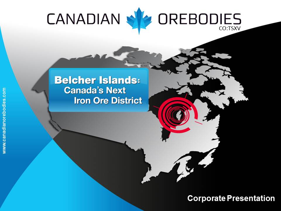
| Click here for a map of the Belcher Islands. | Click here for a map centered on Orebodies' claims. |
On February 6, 2012, the Company announced an initial independent National Instrument (NI) 43-101 Mineral Resource estimate using information from the 2011 drill program. The estimate was completed by G H Wahl & Associates Consulting, and resulted in an indicated iron ore resource of 230 million tonnes at 35.17% iron and an additional inferred resource of 289 million tonnes at 35.47%. In-pit mineral resources were delineated over an area of roughly 9 square kilometers and found to be flat lying. The mineralization extends to the north and south of the property, leaving potential for expansion through further drilling.
The current mineral resources statement for Haig Inlet is presented below.
| Area | Mineral Resource Category | Million Tonnes | %Fe |
|---|---|---|---|
| Haig North | Indicated | 230 | 35.17 |
| Haig North | Inferred | 155 | 35.55 |
| Haig South | Inferred | 134 | 35.37 |
| Haig North | Total Indicated | 230 | 35.17 |
| Haig North & South | Total Inferred | 289 | 35.47 |
Resource Estimate Details
The mineral resource estimate for the Haig Inlet Deposit is based on results from 64 diamond drill holes totaling 9,119.2m and is effective as of February 6, 2012. No cut-off was applied as the lowest grade (27%Fe) within the modeled iron formation lies well above the economic cut-off of 15%Fe. The mineral resources in this press release were estimated using the Canadian Institute of Mining, Metallurgy and Petroleum (CIM), CIM Standards on Mineral Resources and Reserves, Definitions and Guidelines prepared by the CIM Standing Committee on Reserve Definitions and adopted by CIM Council. For further detail, including the mineral resource parameters, please click here to view the NI 43-101 Technical Report.
The Belcher Islands Advantage
The Company is particularly enthusiastic about the Haig Inlet Project because it is located adjacent to tidewater in Hudson Bay, which opens up the possibility for direct ocean shipping to global markets. The ability to ship via ocean freighter without using rail could be a major cost advantage on both the initial capital and operating side when compared to land locked projects.
2012 Exploration Program
Canadian Orebodies' goal for 2012 is to improve its technical knowledge of the Haig Inlet Deposit, and perform regional exploration on a number of highly prospective targets to demonstrate the potential of the Belcher Islands. To that end, the Company plans to undertake mineralogical and metallurgical studies on samples taken from the Haig Inlet Deposit with the goal of establishing a process for creating a high quality iron product. Concurrently, the Company flew up a drill rig in June in order to get an earlier start on drilling this year. The program is designed to test 3 new areas -- Haig West, Haig North, and Kihl Bay -- with the goal of delineating a second iron deposit on the Belcher Islands. Additionally, Canadian Orebodies will be drilling 4 additional holes on the Haig South Area (NI 43-101 Inferred resource of 134Mt @ 35.37%) to improve its geological understanding of the area. Click here for a map of holes drilled during 2012.
Haig West
The Haig West project area is located on the west coast of Flaherty Island (approximately 20km west of the Haig Inlet Deposit) and runs in a north-south direction over a 29.4km strike length. The project covers a strong magnetic trend that extends of the entire length of the target area and coincides with outcropping iron mineralization on the ground. During the summer of 2012, the Company discovered a 4.5km outcrop of magnetite mineralization at the south end of the project that had never been previously mapped. To date, the Company has drilled 13 holes over a 25km strike length and intersected significant widths of iron bearing hematite and magnetite. Below is a table of assays received to date on Haig West:
| Hole ID | From (m) | To (m) | Interval (m) | Total Fe (%) |
|---|---|---|---|---|
| CO-12-09 | 3.00 | 68.00 | 65.00 | 24.74 |
| and | 98.00 | 143.60 | 45.60 | 28.32 |
| incl. | 100.00 | 115.10 | 15.10 | 33.91 |
| CO-12-10 | 249.00 | 275.00 | 26.00 | 28.86 |
| CO-12-12 | 36.40 | 120.85 | 84.45 | 25.13 |
| incl. | 44.00 | 62.00 | 18.00 | 31.48 |
| and | 144.85 | 197.65 | 52.80 | 27.28 |
| incl. | 144.85 | 158.85 | 14.00 | 32.87 |
| CO-12-13 | 39.60 | 51.30 | 11.70 | 28.22 |
| CO-12-13B | 47.60 | 135.80 | 88.20 | 26.19 |
| incl. | 52.00 | 78.30 | 26.30 | 30.27 |
| and | 178.45 | 235.25 | 56.80 | 28.48 |
| incl. | 178.45 | 198.30 | 19.85 | 33.82 |
| CO-12-14 | 10.30 | 99.30 | 89.00 | 25.73 |
| and | 125.90 | 181.80 | 55.90 | 28.93 |
| incl. | 125.90 | 142.05 | 16.15 | 35.93 |
| CO-12-15 | 25.00 | 127.50 | 102.50 | 25.84 |
| incl. | 29.00 | 43.00 | 14.00 | 34.60 |
| and | 157.00 | 211.35 | 54.35 | 28.46 |
| incl. | 158.40 | 173.10 | 14.70 | 34.80 |
| CO-12-16 | 91.10 | 161.15 | 70.05 | 25.98 |
| and | 203.00 | 249.70 | 46.70 | 25.05 |
| CO-12-17A | 58.70 | 149.10 | 90.40 | 25.06 |
| incl. | 62.70 | 72.30 | 9.60 | 32.54 |
| and | 185.75 | 254.00 | 68.25 | 25.85 |
| CO-12-18A | 49.30 | 140.30 | 91.00 | 24.34 |
| and | 201.00 | 251.00 | 50.00 | 25.58 |
| CO-12-20 | 164.30 | 228.45 | 64.15 | 23.84 |
| and | 271.95 | 326.00 | 54.05 | 25.86 |
| CO-12-21 | 219.60 | 260.75 | 41.15 | 26.03 |
| and | 278.15 | 290.15 | 12.00 | 23.34 |
| and | 322.70 | 392.00 | 69.30 | 26.45 |
| CO-12-33 | 40.70 | 119.10 | 78.40 | 26.31 |
| incl. | 47.05 | 60.60 | 13.55 | 32.84 |
| and | 161.00 | 203.00 | 42.00 | 29.41 |
| incl. | 165.90 | 183.00 | 17.10 | 33.39 |
| CO-12-35 | 132.00 | 172.65 | 40.65 | 26.00 |
| and | 189.70 | 201.95 | 12.25 | 24.24 |
| and | 234.00 | 296.00 | 62.00 | 26.18 |
Haig North
Drilling on the Haig North area during 2012 was comprised of 4 holes at 2 kilometer step-outs indicating excellent continuity of the east dipping iron formation over the 8 kilometer strike length. These holes run north along the iron formation on the mid-east side of Flaherty Island, beginning approximately 10 kilometers north of the Haig Inlet Deposit. Below is a table of assays received to date on Haig North:
| Hole ID | From (m) | To (m) | Interval (m) | Total Fe (%) |
|---|---|---|---|---|
| CO-12-03 | 169.25 | 203.00 | 33.75 | 22.91 |
| CO-12-04 | 96.10 | 152.00 | 55.90 | 23.90 |
| CO-12-07 | 73.00 | 133.65 | 60.65 | 24.00 |
| CO-12-08 | 128.00 | 194.00 | 66.00 | 24.00 |
Haig South
Drilling on the Haig South area during 2012 was comprised of 4 holes located around the 2011 drill hole CO11-53. Below is a table of assays received on Haig South:
| Hole ID | From (m) | To (m) | Interval (m) | Total Fe (%) |
|---|---|---|---|---|
| CO-12-22 | 96.15 | 146.30 | 50.15 | 29.13 |
| incl. | 96.15 | 110.15 | 14.00 | 35.40 |
| CO-12-23 | 91.60 | 124.50 | 32.90 | 28.71 |
| incl. | 91.60 | 107.60 | 16.00 | 35.40 |
| CO-12-24 | 60.00 | 73.85 | 13.85 | 22.33 |
| and | 87.85 | 140.00 | 52.15 | 27.81 |
| incl. | 88.65 | 100.65 | 12.00 | 32.85 |
| CO-12-25 | 79.50 | 130.00 | 50.50 | 25.95 |
| incl. | 100.20 | 119.80 | 19.60 | 34.06 |
Kihl Bay
Kihl Bay is an area to the north-east of the Haig Inlet Deposit where the Company collected one of its highest grab samples. Folding in the Kihl Bay target area is interpreted to have created a number of anticlines that may have pushed the iron mineralization close to surface. During 2012, the company drilled 7 holes at Kihl Bay. Below is a table of assays received to date on Kihl Bay:
| Hole ID | From (m) | To (m) | Interval (m) | Total Fe (%) |
|---|---|---|---|---|
| CO-12-06 | 87.65 | 146.00 | 58.35 | 27.34 |
| incl. | 89.65 | 105.90 | 16.25 | 32.03 |
| CO-12-11 | 28.20 | 78.20 | 50.00 | 23.78 |
| CO-12-26 | 34.75 | 86.50 | 51.75 | 23.26 |
| CO-12-29 | 22.80 | 86.15 | 63.35 | 26.51 |
| incl. | 24.80 | 45.65 | 20.85 | 31.35 |
| CO-12-30 | 15.90 | 97.70 | 81.80 | 25.04 |
| incl. | 40.00 | 60.50 | 20.50 | 30.36 |
| CO-12-31 | 32.00 | 117.50 | 85.50 | 28.07 |
| incl. | 50.30 | 76.50 | 26.20 | 35.73 |
| CO-12-32 | 8.00 | 27.50 | 19.50 | 29.18 |
| incl. | 8.00 | 21.50 | 13.50 | 32.26 |
Kugong Island and Wiegand Island
Kugong Island and Wiegand Island are two new areas that the Company acquired during 2012. Wiegand Island was subject to a historical airborne magnetic survey which produced a strong response, and the Company has discovered outcropping iron mineralization on both Wiegand Island and Kugong Island. The company plans to initiate more detailed exploration of these areas in the future.
2011 Exploration Program
From July through September of 2011, Canadian Orebodies completed a drilling program on the Property utilizing 3 diamond drills. In total, 64 drill holes totalling 9,119.2 meters were completed, including 2 drill holes that were abandoned early. All the holes drilled in this program were focused on the Kipalu Formation of iron-bearing rocks, following up on the work previously carried out on the Property in the 1950's by Belcher Mining Corporation Ltd., in the central location around Haig Inlet. The Kipalu Iron Formation is a Paleoproterozoic Superior-type banded iron formation that was deposited between an extensive shallow marine carbonate succession and deep marine turbidites interbedded with mafic volcanics and gabbro sills, which covers a vast area around the Haig Inlet area. The Company is extremely pleased that all the completed holes intersected iron oxide mineralization and the assay results showed excellent continuity of grade and thickness.
The first phase of drilling this season was completed on seven lines spaced approximately 500 metres (m) apart on an area measuring roughly 3km by 3km immediately north of Haig Inlet. On each line, drill holes were also spaced approximately 500m apart. This was followed by infill drilling between lines A, B, and C, and a series of drill holes tracing the mineralization trending 7.5km to the north. The Kipalu Iron Formation in this target area is essentially flat lying with only very slight changes in dip, and drilling has indicated that the iron formation shows excellent continuity over the entire 9 square kilometer area.
| Click here for assay results for the 2011 drill holes. | Click here for a plan map of the 2011 drill holes. | Click here for a list of the drill collar coordinates |